
No products
Prices are tax included
Product successfully added to your shopping cart
There are 0 items in your cart. There is 1 item in your cart.
 View larger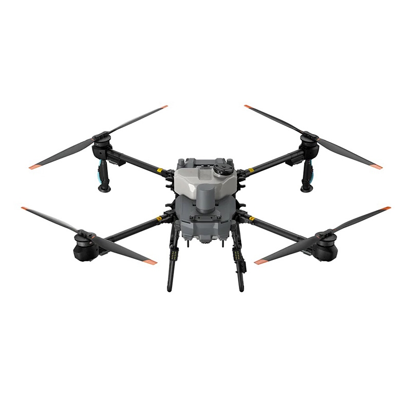
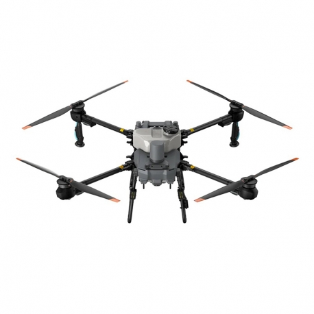
DJI Agras T25P Agriculture Drone
Features:
- Compact and Efficient
- Fully Automatic Operation
- Flexible Operations
- Spreading System 4.0
- Signal Stability
- Safety System 3.0[2]
More info
DJI Agras T25 P
Fly Solo.
The DJI Agras T25P drone retains its compact, foldable design, featuring 20 kg spraying[1], an upgraded 25 kg[1] high-precision screw feeder spreading system 4.0, and Safety System 3.0[2]. It excels in aerial mapping and plant protection, offering flexible operations and convenient mobility, making it ideal for solo operations.
A Drone For Solo Operations
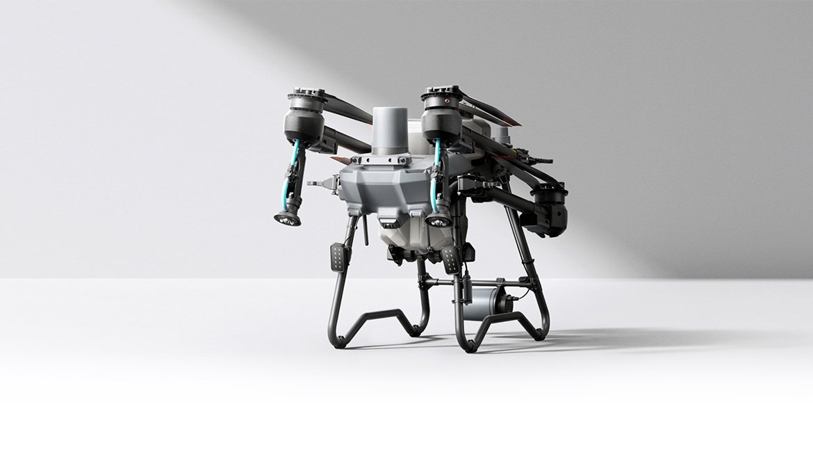
Agras T25P features a foldable design and a lightweight body tailored for solo operations, ensuring flexible mobility and easier takeoff and landing.
Multiple Scenarios
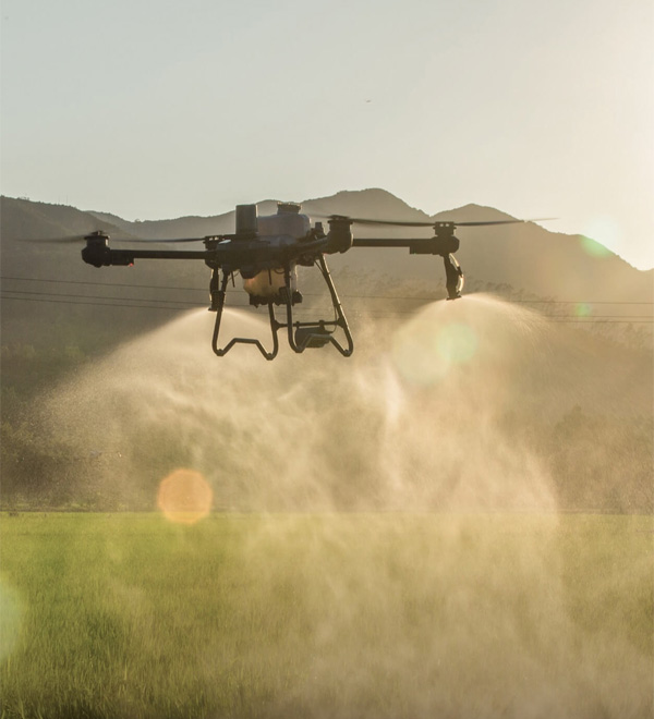
Field Spraying
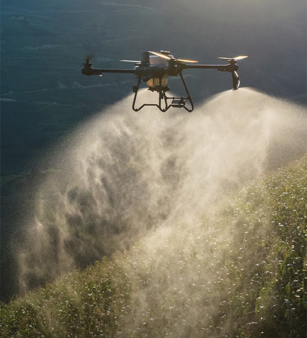
Mountain Spraying
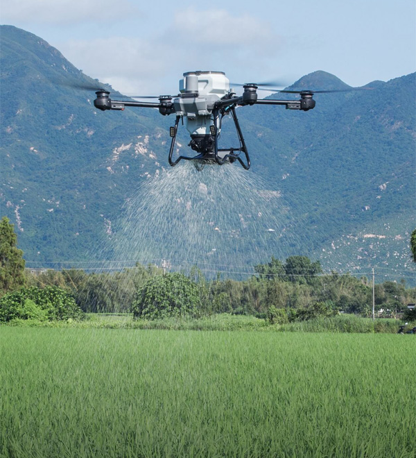
Field Spreading
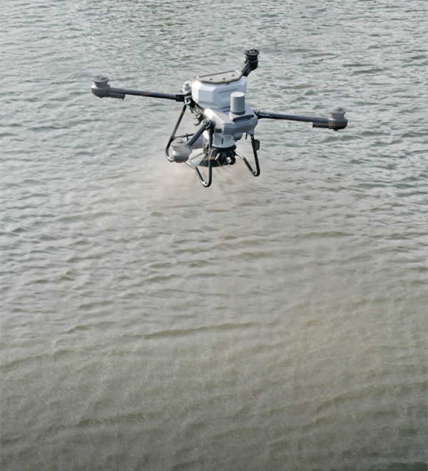
Feed Spreading
Spraying System
Efficient Operation, Outstanding Performance.
The dual atomization spraying system delivers a high flow rate of 16 liters per minute (with 2 sprinklers), ensuring fine and even droplets without leakage. An additional pair of centrifugal sprinklers can be added, increasing the flow rate to 24 liters per minute (with 4 sprinklers), suitable for operations demanding high-volume.
Magnetic Drive Impeller Pump
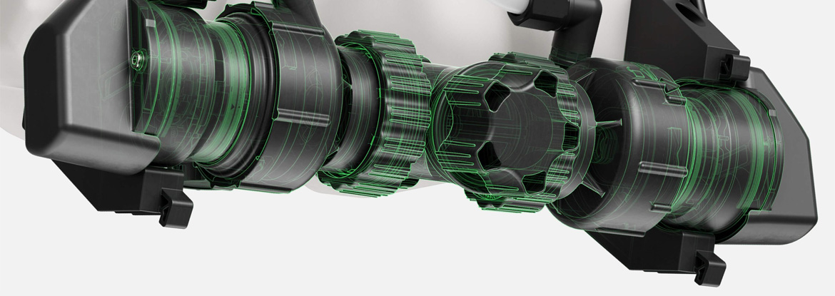
Liquid is completely isolated from the motor, ensuring zero corrosion, exceptional durability, quick disassembly, and convenient cleaning.
Solenoid Valves
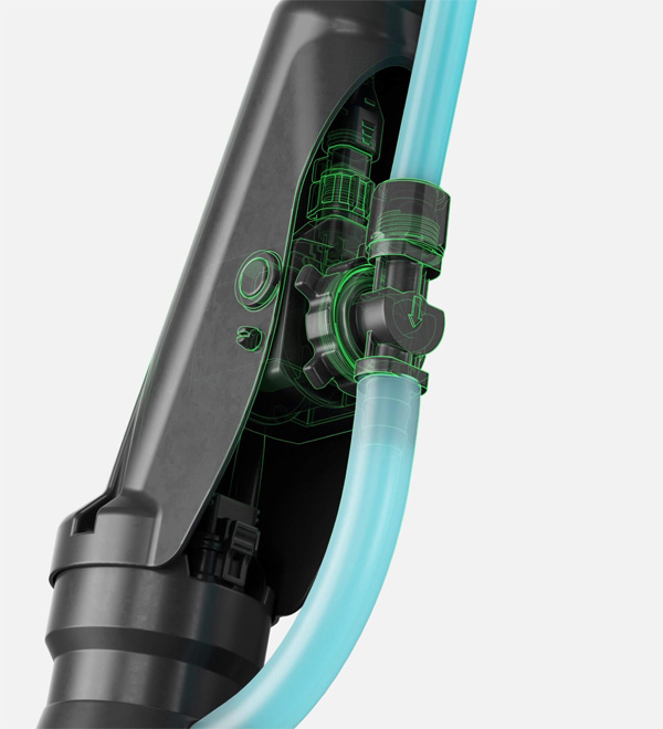
Precision starting and stopping eliminates leaking
Dual Atomizing Centrifugal Sprinklers
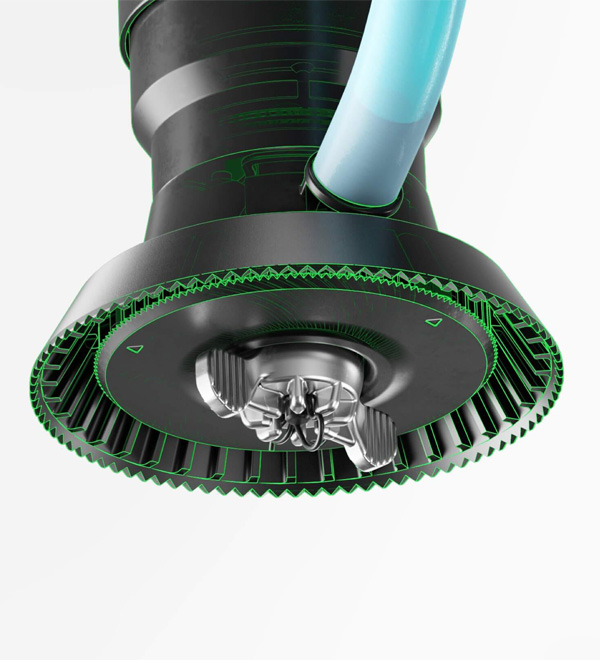
A dual atomizing spray disc structure increases its lifespan by 66%[4] and provides more uniform droplet sizes, for better spray effect.
Spreading System 4.0
High Precision Flow, Multiple Spreading Scenarios
The T25P spreading system offers an 8 m spreading width[5] and features a replaceable screw feeder for doubled flow precision[6] and enhanced adaptability, ideal for fields, mountains, aquaculture, and more.
Adaptable to Various Granulars[3]
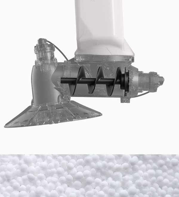
Large Feeder
Suitable for granulars such as fertilizers, wheat seeds, granular fungicides, feed, etc.
Recommended application rate: 75-750 kg per hectare.
Recommended particle size: 0.5-10 mm
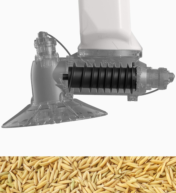
Medium Feeder
Suitable for granulars such as rice seeds.
Recommended application rate: 22.5-120 kg per hectare.
Recommended particle size: 4-6 mm
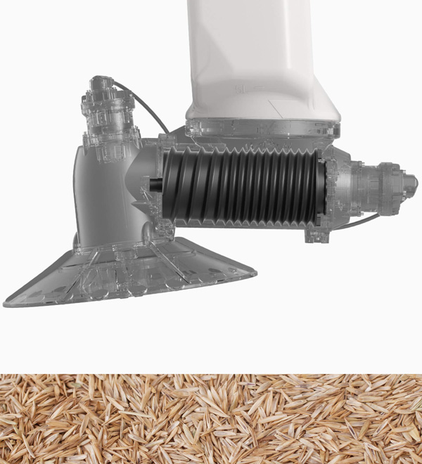
Small Feeder
Suitable for granulars such as rapeseed, granular herbicides, grass seeds, granular insecticides, etc.
Recommended application rate: 3-22.5 kg per hectare.
Recommended particle size: 0.5-4 mm
High Flow, Fast Spreading
The new T25P spreading system supports a 25 kg payload[1] and a 30-liter capacity. It operates at speeds up to 10 m/s, with a spreading width of 8 meters[5] and a max flow rate of 190 kg/min.[7]
Precise and Uniformed Spreading
With a new centrifugal disc, the spreading system ensures uniform distribution with automatic calibration, real-time weighing, cloud-stored templates, and feeder matching for enhanced spreading flow accuracy.
Fast Disassembly and Cleaning
The spreader and feeder are easy to detach and clean, ensuring convenient maintenance.
Safety System 3.0[2]
Powerful Awareness for Comprehensive Safety
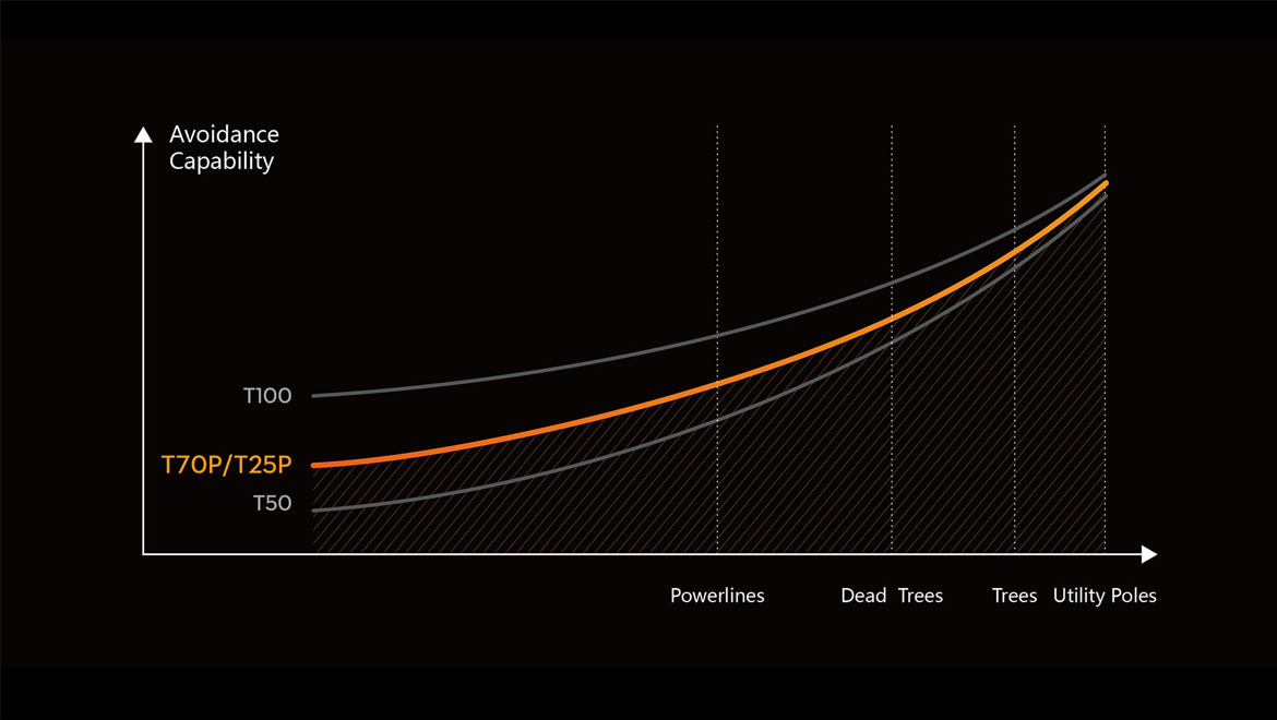
The T25P's upgraded Safety System 3.0[2] features millimeter-wave radar, a 10x increase in avionics computing power[4], and a 60 m[8] tri-vision sensor system for enhanced Terrain Following and obstacle avoidance[4].
Obstacle Avoidance
Safety System 3.0[2] helps T25P detect poles and trees, allowing for confident obstacle avoidance. Low-reflective obstacles like guy wires should still be marked in pre-planning to ensure safer flights.
Virtual Gimbal
T25P introduces an industry-first virtual gimbal, utilizing a fisheye lens and electronic stabilization algorithms to achieve electronic anti-shake, resulting in smoother footage.
Night Vision Color FPV Camera
T25P is equipped with night vision color FPV camera and a 75-watt night navigation lights, allowing clear visibility of obstacles like poles and wires[9] in dim conditions. It offers a viewing distance of up to 25 m, illuminating your night flight path.
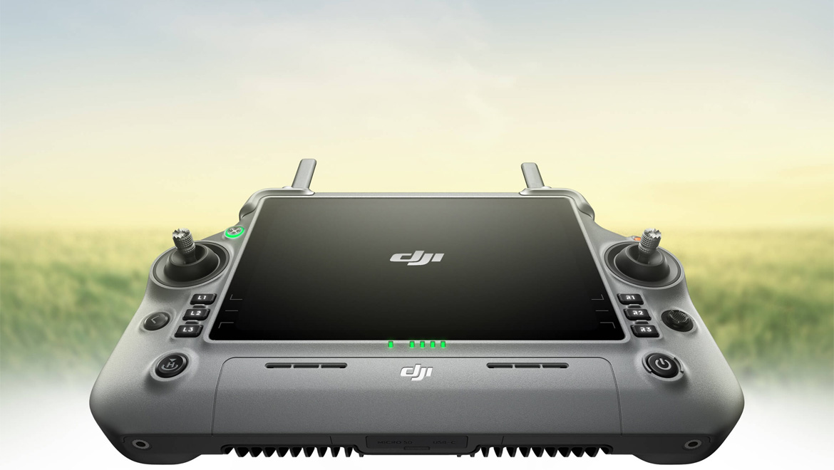
DJI RC Plus
Wide Screen, High Brightness, Easy Control
Multi Field Operations
Efficiently plan multiple fragmented plots in a single go. Enabling continuous operations without interruptions (in fields or orchards).
Practical Features for Manual Mode
Simplify operations on complex small plots with practical tools like one-click plot saving and one-click return to breakpoints, ensuring efficient and stress-free workflows.
Free Flight Paths
Adapt effortlessly to diverse scenarios, including mixed crops, intercropping, and paddy fields. Achieve greater operational flexibility for more efficient workflows.
High Efficiency Mapping[24]
One Click Takeoff, Easy HD Map Generation
Field Mapping
Mapping 13.3 hectares[10] of fields in a single flight. Intelligently detect field and obstacle boundaries, enabling one-click takeoff and fully automatic operations. A super-resolution algorithm ensures clearer maps.
Orchard Mapping
Mapping 5.33 hectares[10] of orchards in a single flight. Supports Orchard Mode 4.0, enabling more features.
Power System
Fuel Efficient, Fast Charging, Rapid Start
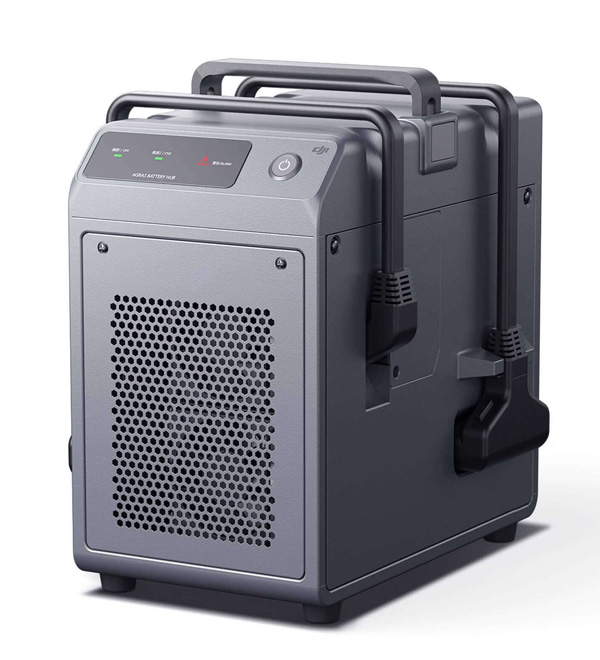
The D6000i Multifunctional Inverter Charging Station and C8000 Intelligent Charger[12] support both fuel and utility power charging. Paired with the DB800 Intelligent Flight Battery, they enable ultra-fast charging.
DB800 Intelligent Flight Battery
Capacity: 15.5 Ah
Warranty: 1,500 charge cycles[13]
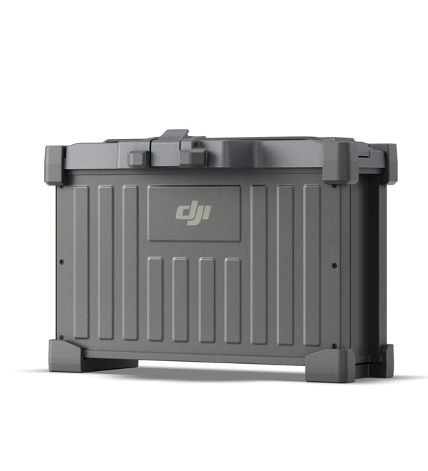
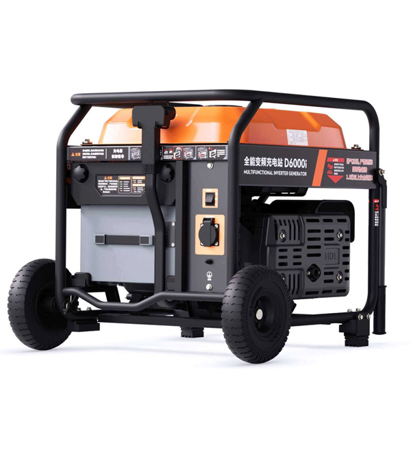
D6000i Multifunctional Inverter Generator
1500 W AC Output[14]
Ultra-fast charging
C8000 Intelligent Power Supply
7200 W fast charging[12]
Dual-channel alternation charging
Power-adaptative protection
- Notes:
- Data was measured at sea level. The DJI Agras app will recommend the payload weight according to the current status and surroundings of the aircraft. When adding materials, the maximum weight should not exceed the recommended value, otherwise flight safety may be compromised.
- The effective sensing range and its ability to avoid and bypass obstacles will vary depending on the ambient light, rain, fog, and the material, position, shape, and other properties of the obstacles. Downward sensing is used to assist in Terrain Following flight and altitude stabilization, while other directions assist with obstacle avoidance. Any collision between the bottom of the aircraft and obstacles shall be the customer's responsibility. In scenarios without linear obstacles, if a collision occurs at speeds up to 10 m/s resulting in aircraft damage, responsibility can be determined through log analysis, and the aircraft may be eligible for free warranty if non-human causes are identified. If there are linear obstacles like wires or guy wires on utility poles, please mark them as obstacles; otherwise, failure to bypass them will be the customer's responsibility. Note 1. Downward sensing assists in Terrain Following flight. If the bottom collides with obstacles, it is considered user responsibility. Note 2. Due to limitations in safety system performance, the aircraft cannot automatically avoid moving objects, and accidents of this nature will be attributed to user responsibility.
- Particle size range: 0.5-10 mm materials. Clumps, straw, woven bags, and impurities, as well as humidity, density, hardness, and shape, can affect spreading adaptability and precision.
- Compared to the Agras T25 drone and its supporting equipment. Test results may vary based on different testing conditions.
- Measured at an operating height of 3 meters with a spinning disc speed of 1,100 r/min and a uniformity requirement of CV < 30%. Higher disc speeds and flight altitudes increase the spreading width.
- Measured with compound fertilizer. The maximum flow rate may vary due to differences in granule size, density, and surface smoothness of different fertilizers.
- Measured with compound fertilizer. The maximum flow rate may vary due to differences in granule size, density, and surface smoothness of different fertilizers.
- The observation distance of Safety System 3.0 may vary due to environmental light, rain, fog, and the material, position, and shape of the target object.
- Under good conditions, the stable observation distance for an 11 mm diameter white wire is 19 meters, and for a utility pole, it is 25 meters. Actual observation distance is affected by lens contamination, insects, spray droplets, fertilizers, and other floating objects. During night flights, users should mark obstacles or reduce flight speed based on actual visible distance to ensure flight safety.
- The mapping area refers to the area enclosed by the flight path. The area per flight is affected by firmware version, takeoff power, survey type, altitude, environmental wind speed, plot shape, slope, etc., and must be conducted without load.
- Measured at a flight altitude of 2.5 meters, without obstruction or electromagnetic interference.
- Output power may vary due to local grid conditions, such as distance, wire material, and wire diameter.
- Batteries are covered by warranty for up to 1,500 charging cycles or 12 months, whichever ends first.
- The output power of the charging station may be affected by altitude and fuel quality.
- The droplet diameter is measured by a laser particle size analyzer, with a 50-micron diameter using the DV50 standard.
- Measured by laser particle size analyzer, a 50-micron diameter using the DV75 standard.
- The effective spray width of the spraying system depends on the actual working scenario.
- Different granulars have different densities, the maximum load cannot exceed 100 kilograms.
- A weight of 100 kg is measured below the triaxial force sensor (including the weight of the sling, and hook). Data was measured at sea level. The DJI Agras app will recommend the payload weight according to the current status and surroundings of the aircraft. When adding materials, the maximum weight should not exceed the recommended value, otherwise flight safety may be compromised. Users must comply with local regulations during operation.
- The rear radar is configured in accordance with the regulations of various countries, and the actual product is subject to the arrival.
- Different granulars have different densities, the maximum load cannot exceed 70 kg.
- A weight of 65 kg is measured below the triaxial force sensor (including the weight of the sling, and hook). Data was measured at sea level. The DJI Agras app will recommend the payload weight according to the current status and surroundings of the aircraft. When adding materials, the maximum weight should not exceed the recommended value, otherwise flight safety may be compromised. Users must comply with local regulations during operation.
- Different granulars have different densities, the maximum load cannot exceed 25 kilograms.
- Mapping operation needs to work with RTK.
| Aircraft | |
|---|---|
| Weight |
|
| Max Takeoff Weight[1] |
|
| Max Diagonal Wheelbase | 1970 mm |
| Dimensions |
|
| Hovering Accuracy Range (with strong GNSS signal) |
|
| Max Configurable Flight Radius | 2000 m |
| Operating Temperature | 0° to 40° C |
| Max Wind Resistance | Level 3 wind (<6 m/s) |
| Propulsion System - Motors | |
| Stator Size | 100×28 mm |
| KV | 59 RPM/V |
| Propulsion System - Propellers | |
| Material | Nylon carbon fiber |
| Dimensions | 50 in |
| Quantity | 4 |
| Spraying System - Spray Tank | |
| Material | Plastic (HDPE) |
| Volume | 20 L |
| Operating Payload | 20 kg |
| Spraying System - Sprinklers | |
| Model | LX07550SX |
| Quantity | Standard Configuration 2 |
| Nozzle Distance | 1420 mm (Rear Nozzles) |
| Droplet Size | 50-500 μm |
| Effective Spray Width[2] | 4-7 m (at a height of 3 m above the crops) |
| Spraying system - Delivery Pumps | |
| Type | Impeller Pump (Magnetic Drive) |
| Quantity | 2 |
| Max Flow Rate |
|
| Spreading System 4.0 | |
| Compatible Material Diameter | 0.5-5 mm dry granules |
| Spreading Tank Volume | 30 L |
| Spreader structure type | Centrifugal Disc |
| Discharge Structure Type | Feeder Feeding |
| Max Discharge Rate | 190 kg/min (compound fertilizer) |
| Max load inside the spreading operation box | 25 kg |
| Effective spreading width[3] | 3-8 m |
| Safety System 3.0 | |
| Millimeter-Wave Radar EIRP | <20 dBm (NCC/MIC/KC/CE/FCC) |
| Operating Temperature | 0° to 40° C; |
| Operating Environment | Adequate light and discernible surroundings |
| Operating Frequency | 24.05-24.25 GHz (NCC/FCC/MIC/KC/CE) |
| Field of View (FOV) |
|
| Range[4] | ≤ 60 m |
| Effective safe obstacle avoidance speed[5] | ≤ 10 m/s |
| Effective Obstacle Avoidance Height | ≥ 1.5 m |
| Remote Controller | |
| Model | TKPL 2 |
| Screen | 7-inch LCD touchscreen; resolution: 1920×1200; brightness: 1400 cd/m² |
| Storage Temperature Range |
|
| Charging Temperature | 5° to 40°C |
| Internal Battery Runtime | 3.8 hours |
| External Battery Runtime | 3.2 hours |
| Charging Type | It is recommended to use a locally certified USB-C charger at a maximum rated power of 65 W and maximum voltage of 20 V such as the DJI 65W Portable Charger. |
| Charging Time | 2 hours for internal battery or internal and external battery (when remote controller is powered off and using a standard DJI charger) |
| DB800 Intelligent Flight Battery | |
| Weight | Approx. 6.6 kg |
| Capacity | 15500 mAh |
| Nominal Voltage | 52.22 V |
| D6000i Multifunctional Inverter Generator | |
| Battery charging time[6] | To fully charge one battery (DB800 battery) takes 9-12 mins |
| Fuel tank capacity | 20 L |
| Starting Method | Starting the Generator via the One-Button Start Switch |
| Max Power of Engine | 6 kW |
| Fuel type | Unleaded gasoline with RON ≥91 (AKI ≥87) and alcohol content less than 10% (*Brazil: unleaded gasoline with RON ≥ 91 and alcohol content of 27%) |
| Reference fuel consumption | 600 ml/kWh |
| Engine Oil Capacity | 0.8 L |
| Engine Oil Model | SJ10W-40 |
| C8000 Intelligent Power Supply | |
| Dimensions | 300×280×230 mm |
| Weight | 11.5 kg |
| Input | 100-240 Vac |
| Output | Output Voltage: 59.92VOutput Current: 100A max |
| Charging Time[6] | Fully charges a battery in 9 to 12 minutes (DB800 Intelligent Flight Battery) |
| Protection Functions | Over-voltage, over-charge, under-voltage and over-temperature protection. |
| Charging Safety | AC wire protection, power wire protection, and charge connector protection |
| Annotation |
|